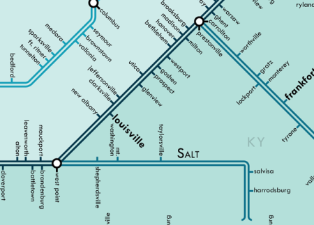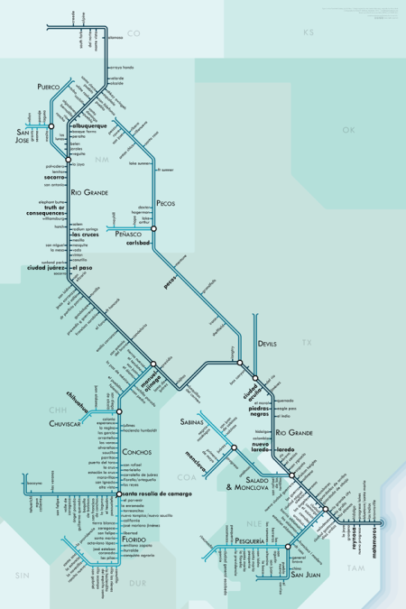
Madison-based cartographer Daniel Huffman has created a series of River Maps that mimic Modern urban transit maps, “perfect for the urbanite who cannot comprehend nature without it being translated into a more constructed language.” Hmm, that sounds like me.
The depicted geography is distorted to clarify relationships, and distances are equalized. Shown here is the Ohio River around Louisville, Dayton and Cincinnati.


Above, Lower Ohio. Below, Rio Grande and Red and Arkansas Rivers.


The design of the river maps is based on the unrelenting Modernism of Harry Beck’s London Underground Tube map of 1933 and Massimo Vignelli’s NYC subway map of 1972, shown below. The result is a series of 45- and 90-degree lines that shows relevant relationships while distorting size and distance.

See Huffman’s portfolio for other interesting maps, or purchase a map print from him. On a different note, his deeply personal explanation of why and how he ended up pursuing cartography can be inspiring to anyone who’s ever felt lost in school. Via the always excellent CMYBacon.

This is a great site. Glad to have found it.
Very interesting, and a refreshing change from the Modern “design fetish” maps you’ve posted before. These exhibit more rigor in my opinion.
You’ve got a point — sometimes beautiful design isn’t the best cartography. This isn’t necessarily the best design, but it’s well-executed and clever. I really enjoyed rooting around through Huffman’s portfolio and blog; he seems like a really smart, thoughtful person.